
Basic
For the solo operator getting off the tape measure.
$22/mo
or $240/year
- 500 properties
- 1 user
- 500 credits
- 1 GB storage
- On-Device included

AI measurements, high-resolution imagery, On-Device AR + LiDAR scanning, and desktop tools come with every plan. You choose the tier by how much you measure — properties, users, and credits — not by which features you’re allowed to touch.
Start your free trialSave ~9% when you pay annually.
For the solo operator getting off the tape measure.
or $240/year
For the growing crew bidding every week.
or $600/year
High-volume estimating across a bigger book of business.
or $2,400/year
Self-measuring with Google or Mapbox images is free. Premium measurements using AI detection and high-resolution imagery cost approximately one credit per acre. Your full year of credits is available the day you subscribe, whether you pay monthly or annually.
Need more? Add them in 50-credit bundles.
Measure properties on-site with AR + LiDAR on your iPhone or iPad. Works fully offline, all data is stored on your device or iCloud.
7-day free trial • Measure one complete property free
Get On-Device on the App Store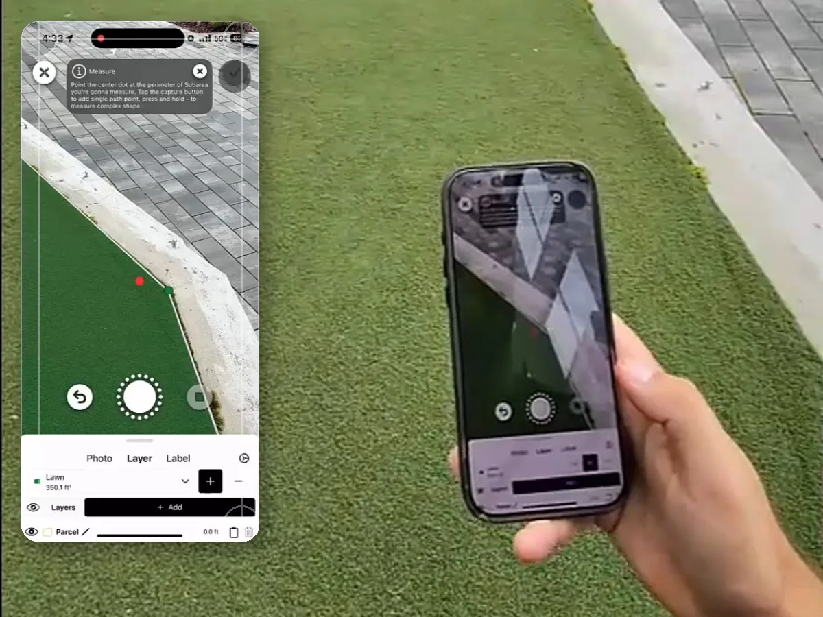
Need more than measuring?

LaunchPad OS replaces the many tools you’re juggling with a system of intelligence that doesn’t just record what happened — it acts on it.
Software built for how your operation actually runs, including every tool you’ll need: business management, CRM, marketing, texts/calls, property measuring in LaunchPad Map, smart routing, mobile, photos/documents, reviews, reputation — and more. No expensive add-ons or integrations required.
LaunchPad Map is included in every LaunchPad OS plan.
Get started
Join your peers who are already measuring faster, quoting with confidence, and winning more work by delivering estimates before the competition. Start your 7-day free trial today; no credit card required. Measure your first property in minutes — remote or on-site.
No long-term contract, cancel anytime.
Your measurements are yours to keep; export to PDF, image, CSV, or DXF anytime.
Start measuring right away. You get 7 days free as part of your LaunchPad Map trial, no credit card required. Want proof before you pay? Send us an address and our team measures it for you, free. (LaunchPad Map On-Device has its own 7-day trial that includes one complete property measurement.)
Self-measuring with Google or Mapbox imagery is always free, no credits. Premium measuring with AI auto-detect or high-resolution HD imagery from Nearmap uses one credit per acre.
Each address you measure and save is one property against your plan’s allowance. Basic includes 500 properties. If you need more, you can purchase in bundles of 1,000. Remeasuring the same address again doesn’t cost double — it counts as one property record, no matter how many times you open it.
Right away. Your full year of credits lands in your account the day you subscribe, whether you pay monthly or annually. (Basic starts at 500 credits; Pro, 2,000 credits; and Ultra, 10,000.)
Yes, you can upgrade or downgrade anytime. Credits and properties you’ve already got stay with your account.
You keep every credit you’ve earned and are only charged for what you used beyond that. Earned credits = (months subscribed ÷ 12) × your plan’s annual credits; credits used above and beyond your earned credits are billed at $0.50 per credit upon cancellation. If you’ve stayed under that limit, there’s nothing to true up.
Yes. Every LaunchPad Map plan includes On-Device. Walk the site, scan with AR + LiDAR (even fully offline), and it syncs back to your account automatically. Just want the on-site app on its own? LaunchPad Map On-Device is also on the App Store as a standalone subscription for $10/mo or $99/yr.
PDF, image, CSV, and DXF files, plus a shareable interactive map link and annotated reports for your clients and crews. From an on-site LiDAR scan, you can also export a 3D-terrain model as an .OBJ for design software.
Remote measuring runs in any desktop browser. On-site scanning runs on iPhone and iPad — you’ll need a LiDAR-equipped device (iPhone 12 Pro/Pro Max or newer, or an iPad Pro) with the LaunchPad Map app.